Social Media

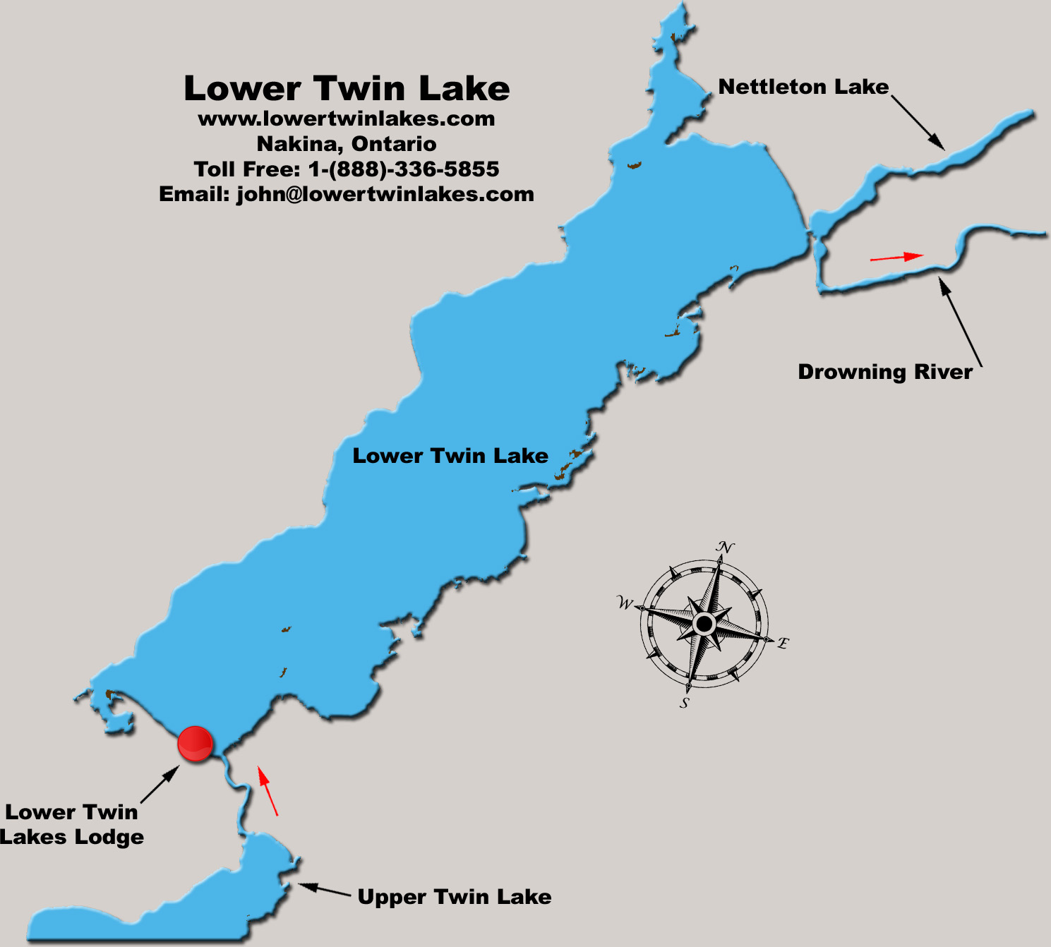
Max Depth: 64 feet
Average Depth 18.8 feet
Shoreline: 13.2 miles
Elevation Above Sea Level: 981 feet
Coordinates: 50.1572° N, 86.5852° W
Fish Species: Walleye (Yellow Pickerel), Northern Pike, Perch, Whitefish & Burbot (Ling)
Please Note: There are big trophy Brook Trout in the Drowning River System but they are too far down stream to reach by boat. Upper and Lower Twin Lakes are the headwaters for the Drowing River and the water has to run through a few sets of rapids before oxygen levels are high enough. The closest the Brook Trout get to Lower Twin Lake is in the spring when they sit in the rapids below Relief Lake waiting for the May Flies to hatch.
Printable Maps in Adobe .pdf: (Upper Twin) (Lower Twin)
 Please click here to download Adobe .pdf reader